From sand dunes and mountains to plateaus and farm land, and from cars to copper, Michigan has it all. Ask a Kent City third-grader if you want to know more.
Recent lessons In Monica Moore’s classroom included studying the shape of both the upper and lower peninsulas, natural resources and major industries found in the state, landform descriptions, locating cities and bodies of water including the four Great Lakes surrounding Michigan.
“This activity is a culminating task for the unit in geography,” said Moore. “We have studied all of these different locations, maps, etc., and not we are putting all of that new knowledge together in a presentation. One of the standards in our curriculum states that students will give an oral presentation, so this is a fun way to do that.”
Map of my own
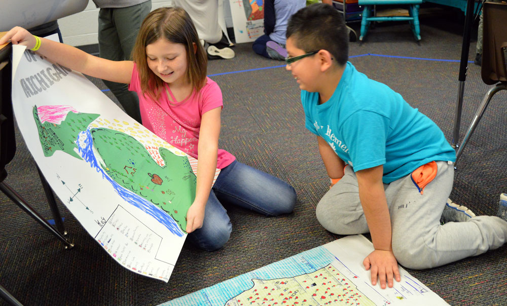
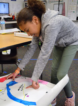
Students were sent home with a checklist of items expected on their finished project, but then were on their own. Actual map-making was left to individual creativity. Mitten shapes were constructed from or drawn on cardboard boxes, presentation poster board, wooden frames or construction paper.
Each mapmaker chose what he or she wanted to highlight. With a requirement of two different kinds of bodies of water, not including the Great Lakes, some chose nearby rivers, such as the Rogue, and local lakes including Long Lake, close to where they live. Many of the maps showed Grand Rapids and suburbs to the north, most included Detroit and all identified the state capitol in Lansing.
Some made topographical maps with added details such as artificial greenery, rivers constructed from blue pipe cleaners, forests made of sticks and one sported a small metal car glued firmly near Detroit.
“I am always surprised by how much effort is put into these projects and how amazing they turn out to be,” Moore said. “Students are so creative, and it is awesome to see that presented in this way.”

Demonstrating New Knowledge
Oral presentations confirmed that map-making leads to new found knowledge, Moore said. “I love seeing how much they can now tell about Michigan after this unit. It shows all the areas they never knew about before.”
Lydia Bulliss. said she has been across the Big Mac many times, “but I never knew that Lake Michigan was on one side and Lake Huron on the other.”
Bryan Gomez was “surprised that there were so many cherries in Michigan. I knew about the apples, but there are lots of cherries too.”
“I really didn’t know that you could find copper in Michigan,” said Aiden Kamphuis.
Added Samantha Oberg: “Plateaus are flat lands and they are in all parts of the world, not just Michigan.”
Both Sebastian Barera-Villa and Tristan Wilson said they found it interesting that there are sand dunes all around the edge of Michigan.
Some students learned that islands are also part of the state. “I really didn’t know that there was an island right there,” said Kendrix Nelson, pointing to Mackinac Island, “and you can only get to it by ferry.”